Solution calculation
Lower cost, More Functions, Great Value for You!
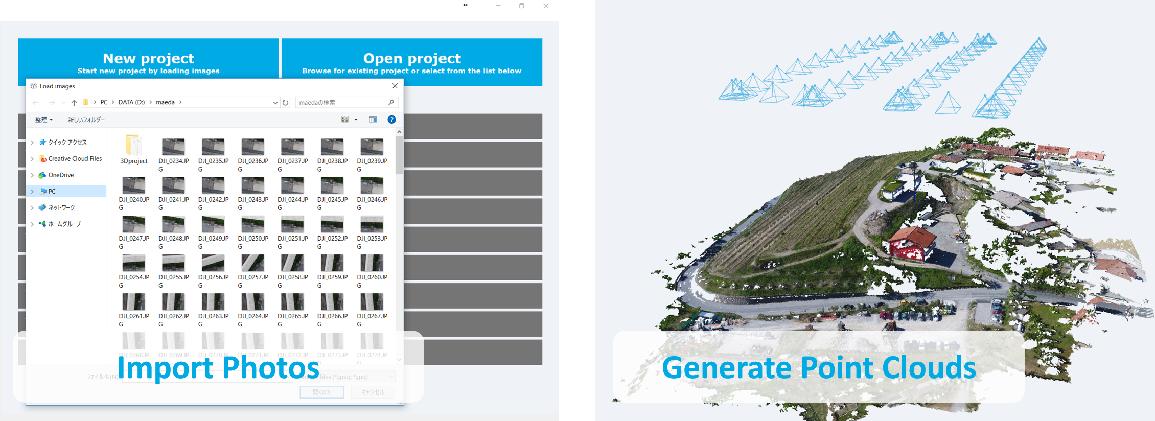
Terra Mapper is a single platform for photogrammetry
that convert photos into 3D point clouds and orthomosaic images.
The ability to create accurate 3D modeling from raw data captured
from drones and ground cameras is now completed was ease.
All the information from a drone flight will be fluently and succinctly analyzed on Terra Mapper Desktop!
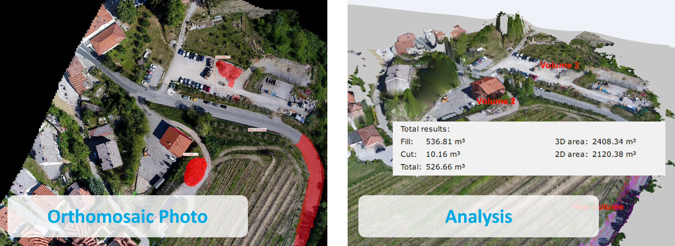
Analyze Data :
This is not only a SfM estimation software,
but also a comprehensive analytic tool.
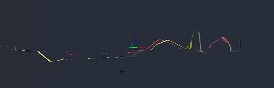
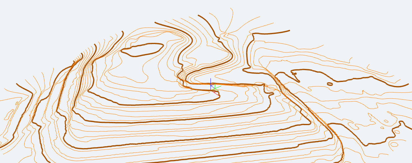
The possibility to inspect the ongoing differences between several point clouds or surfaces,
is one of the analytic advantages of Terra Mapper.
Loading two point clouds from the same place, at a different time using Bounding Box tool
will clearly and accurately compare the difference between data collection periods.
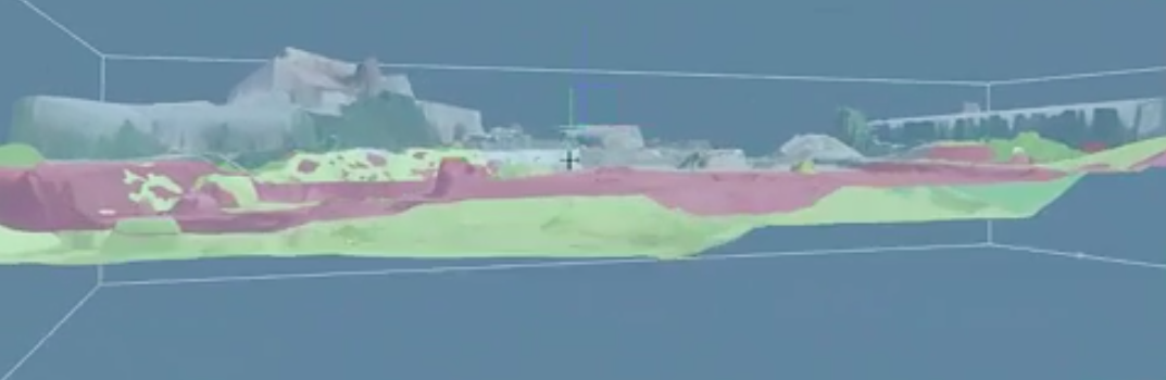
Apply colour coding to a range surfaces to highlight comparisons found in the data.
Additionally, you can calculate contour lines from the same data autonomously,
leaving the results in your hand within seconds.
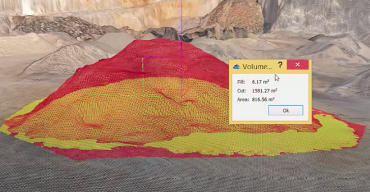
Volume Calculation & Comparison
Terra Mapper simply and elegantly calculates various different volumes from a rang of materials.
The program can create Digital Surface Model with only a single click.
Intelligent calculations allow you to compare the information of multiple volumes derived from multiple dates.
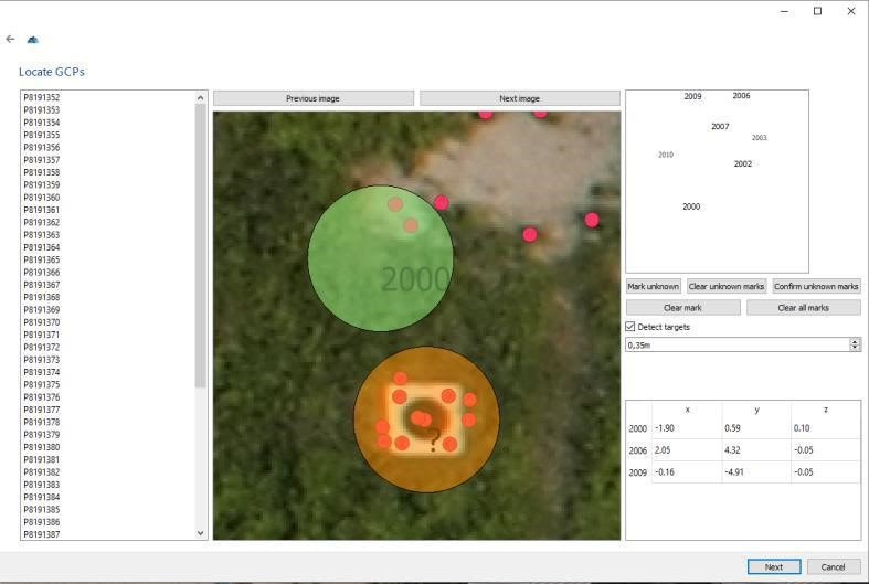
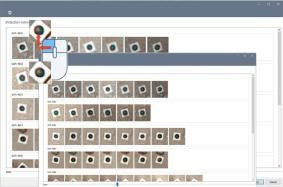
Automatic Ground Control Point Detection
You only have to detect 3 GCP manually, Terra Mapper will detect the rest.
Reducing manual selection dramatically.
CAD software linkage
Compatible with third party software enabling editing and analysing in greater detail.
Supports various output formats including:
Image: JPEG, GIF, PNG, TIFF, PDF, etc.
Point group: CSV, LAS, TXT, etc.
CAD: DXF etc.
Basic Functions of Terra Mapper