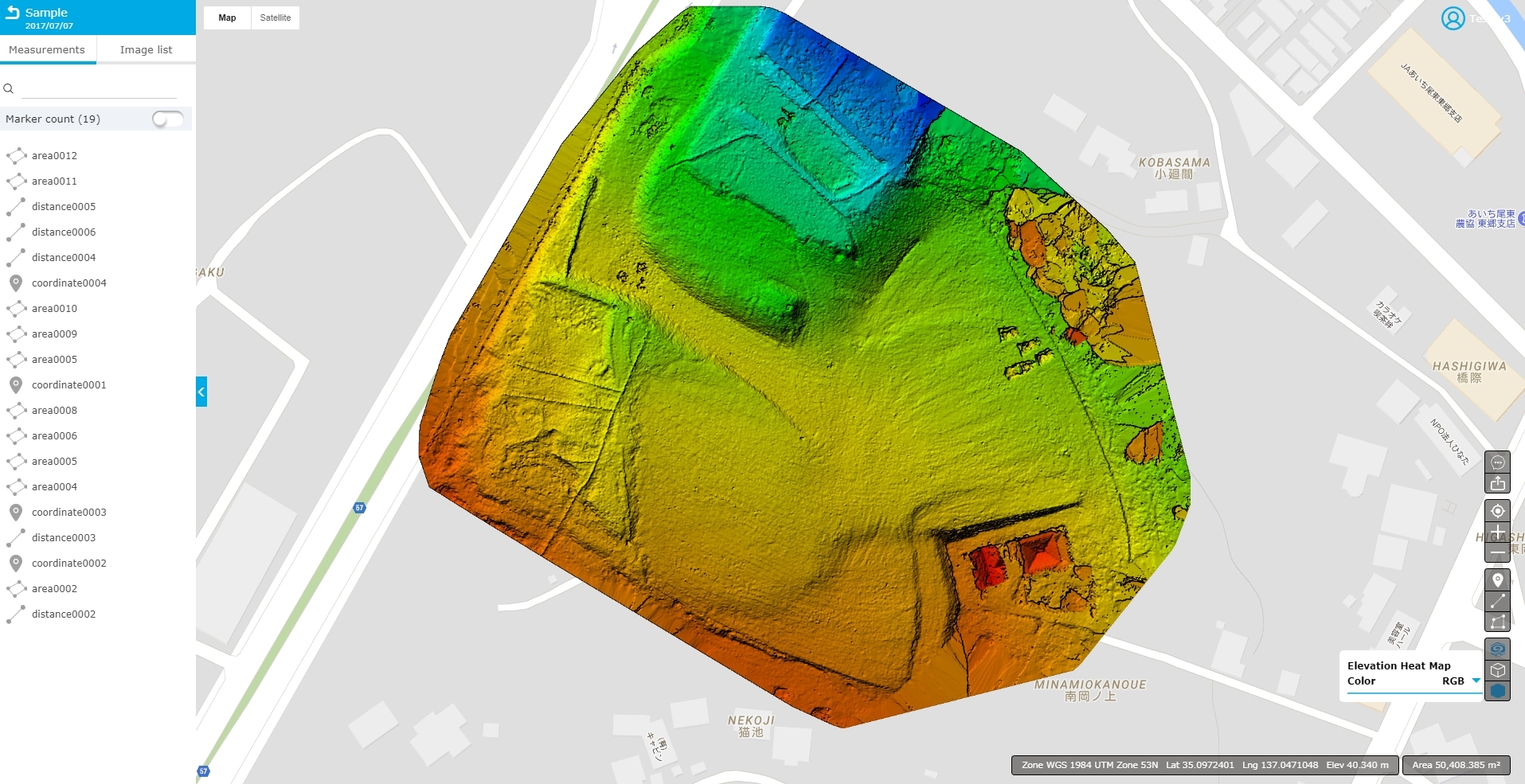
• JP
  • EN
  • PRODUCT
    • DESKTOP
    • CLOUD
  • PRICING
    • DESKTOP
    • CLOUD
  • SUPPORT
  • CONTACT

Elevation | Terra Mapper

Terra Mapper
  • PRODUCT
    • DESKTOP
    • CLOUD
  • PRICING
    • DESKTOP
    • CLOUD
  • SUPPORT
  • CONTACT

Elevation

Display heat map

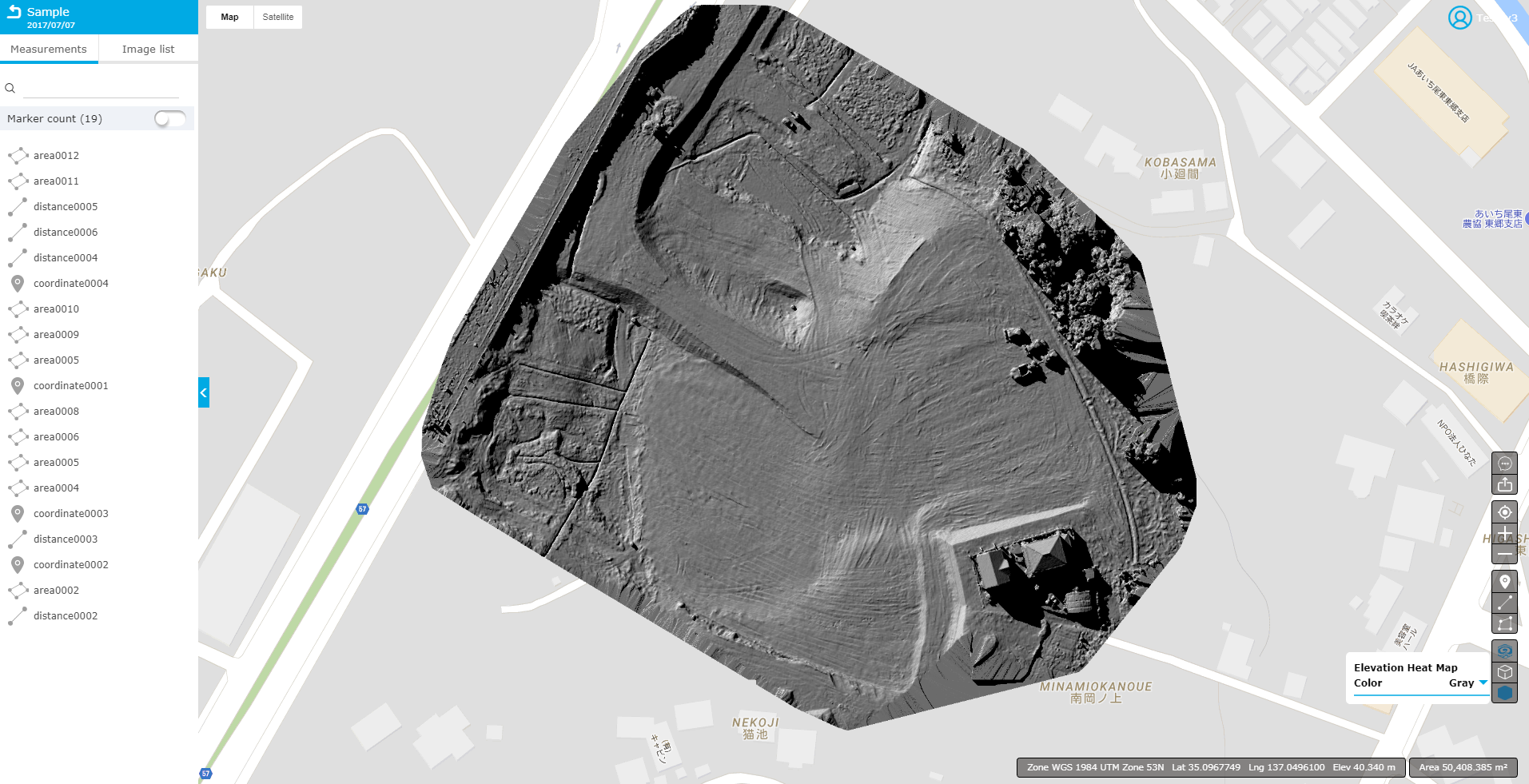
1. Display heat map in RGB / Gray.

※Note: The heat map display may take some time.


①RGB · · · Display height difference in RGB.


②Gray · · ·Display height difference in gray scale.


Page Back

Account management

  • About the handling of personal information
  • Contract plan
  • Storage location of data information
  • About creating multiple accounts
  • Change and cancellation of plan
  • Forgot / change password
  • Cancellation

Advance preparation

  • Recommended environment
  • Login

Analysis

  • Toolbar list
  • Image list
  • chat
  • GPS
  • Coordinate
  • Distance
  • Area
  • 3D map
  • Elevation
  • Comparison of distance and area
  • Comparison

Data creation

  • Project creation

Output

  • Output of data
  • Point cloud
  • Elevation
  • Ortho image
  • Area / volume
  • Distance
  • Coordinates
  • Cross
  • TOP
  • PRODUCT
  • - DESKTOP
  • - CLOUD
  • PRICING
  • - Desktop
  • - Cloud
  • About Terra Drone
  • About Us
  • Contact Us
  • Terms of service
  • Privacy Policy

Terra Drone Corporation

Addresss: Level 3   315 Brunswick Street   Fortitude Valley   QLD 4000 Australia
TEL: (+61) 0415 224 541 Mail: moc.reppam-arret@troppus
  • facebook
  • linkedin
  • twitter

テラドローン株式会社

© 2025 Terra Drone Corp.