Streamline construction management
-

Efficient It is possible to manage a data processing on the Web. If you have an internet environment, you can access from PC, smartphone and tablet. You can start using our product immediately without speccific software or initial investment in PC.
-

Easy Simple operation. The data after the flight is sent to the cloud and automatically processed as 2D / 3D data.
-

Accuracy Compared to traditional surveying, a data can be managed three-dimensionally, and able to create a detailed ground surface data.
Product
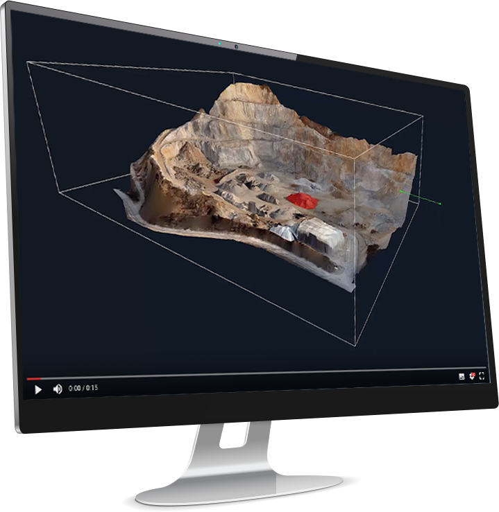
Terra Mapper
Desktop
With the Desktop Terra Mapper, you can perform accurate data analysis on the one application. This data is necessary for drone surveying.
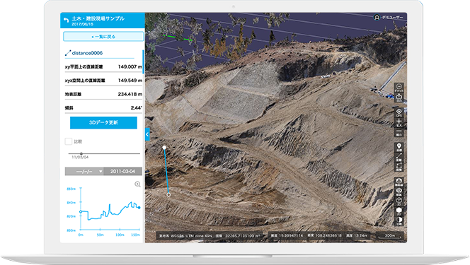
Terra Mapper
Cloud
With the Cloud type of Terra Mapper, you can perform simple data analysis
wherever you are, and this is a Web application enables you to share
the data with other people.
Media
-
Terra Mapper and Terra UTM Website Moved.
Terra Mapper and Terra UTM Website have been move to the following;
・Terra Mapper Website
old URL https://terra-mapper.com
↓
new URL:https://mapper.terra-drone.net/
・Terra UTM Website
old URL https://terra-utm.com
↓
new URL:https://utm.terra-drone.net
Please update your bookmarks. -
Terra Mapper WEB Open!
Terra Mapper is a single platform that speeds up the data processing time taken by drones.